Category:Snow in Dumfries and Galloway
Jump to navigation
Jump to search
Media in category "Snow in Dumfries and Galloway"
The following 62 files are in this category, out of 62 total.
-

-
 'Step over into a Winter Wonderland'.jpg 4,579 × 2,855; 6.72 MB
-
 A Cool Seat - geograph.org.uk - 5678465.jpg 2,976 × 1,984; 2.93 MB
-
 A fence leading up to Firthhope Rig - geograph.org.uk - 726021.jpg 640 × 480; 138 KB
-
 A snow plastered dyke - geograph.org.uk - 286163.jpg 640 × 480; 104 KB
-
 A track at Jock's Hope - geograph.org.uk - 1071130.jpg 640 × 427; 121 KB
-
 A track at Rigfoot - geograph.org.uk - 1078175.jpg 427 × 640; 137 KB
-
 A74 North of Moffat - geograph.org.uk - 94213.jpg 640 × 429; 77 KB
-
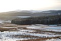
 Afton Reservoir from Meikledodd Hill. - geograph.org.uk - 111511.jpg 640 × 409; 49 KB
-
 Auchenskew Cottage and farmstead - geograph.org.uk - 1074099.jpg 640 × 480; 136 KB
-
 Barlennan - geograph.org.uk - 1627311.jpg 640 × 480; 80 KB
-
 Blackquarter Forest seen from Glasnick Smithy Croft - geograph.org.uk - 1768787.jpg 3,264 × 2,448; 1.68 MB
-
 Cairnsmore of Carsphairn - geograph.org.uk - 764144.jpg 640 × 426; 37 KB
-
 Cairnsmore of Carsphairn - geograph.org.uk - 764149.jpg 640 × 426; 38 KB
-
 Cairnsmore-of-carsphairn-skiing.jpg 600 × 429; 125 KB
-

-
 Cornicing on Saddle Yoke - geograph.org.uk - 652282.jpg 360 × 640; 26 KB
-

-
 Disused quarry - geograph.org.uk - 1074033.jpg 640 × 480; 140 KB
-
 Disused quarry - geograph.org.uk - 1074040.jpg 640 × 480; 139 KB
-
 Dog-leg in forest track - geograph.org.uk - 1074116.jpg 640 × 480; 124 KB
-
 Drifting snow by a drystane dyke - geograph.org.uk - 725988.jpg 480 × 640; 139 KB
-
 Entering the forest - geograph.org.uk - 1074304.jpg 640 × 427; 128 KB
-
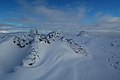
 Fences on Hart Fell summit plateau - geograph.org.uk - 1733184.jpg 640 × 480; 54 KB
-
 Firthope Rig Fenceline - geograph.org.uk - 131965.jpg 640 × 480; 91 KB
-
 Firthope Rig with Snow - geograph.org.uk - 131960.jpg 640 × 480; 110 KB
-
 Following a fence up to White Coomb - geograph.org.uk - 726012.jpg 640 × 480; 151 KB
-

-

-
 Forest road and the Rhinns of Kells - geograph.org.uk - 1152585.jpg 640 × 493; 99 KB
-
 Forest track - geograph.org.uk - 1074158.jpg 640 × 480; 128 KB
-
 Forest track - geograph.org.uk - 1074180.jpg 640 × 480; 136 KB
-
 Forest track - geograph.org.uk - 1074217.jpg 640 × 480; 127 KB
-
 Forest Track - geograph.org.uk - 1076888.jpg 640 × 480; 90 KB
-
 Forest track near hilltop junction - geograph.org.uk - 1074186.jpg 640 × 480; 128 KB
-
 Just after noon, Xmas Day, 2010 (geograph 2215355).jpg 1,024 × 768; 347 KB
-
 Loch Skene Winter.jpg 624 × 468; 91 KB
-
 Looking towards track end - geograph.org.uk - 1074111.jpg 640 × 480; 138 KB
-
 March snow in the Moffat Hills - geograph.org.uk - 725975.jpg 640 × 480; 144 KB
-
 Meikle Millyea and Milldown - geograph.org.uk - 1115564.jpg 640 × 480; 44 KB
-
 Peat hag snow drift - geograph.org.uk - 726022.jpg 480 × 623; 130 KB
-
-

-

-
 Snow covered slopes in the Moffat Hills - geograph.org.uk - 725997.jpg 639 × 455; 155 KB
-
 Snow drifts on Milldown - geograph.org.uk - 1115573.jpg 480 × 640; 33 KB
-
 Snow on the side of Meaul - geograph.org.uk - 1141770.jpg 640 × 480; 51 KB
-
Snowing samye ling jan 10 2.ogv 25 s, 640 × 480; 3.01 MB
-
Snowing video samye ling 1.ogv 21 s, 640 × 480; 13.84 MB
-

-

-
 The road to Auchendolly - geograph.org.uk - 648715.jpg 640 × 480; 259 KB
-

-
 The summit of Firthhope Rig - geograph.org.uk - 726007.jpg 640 × 480; 143 KB
-
 The summit of White Coomb - geograph.org.uk - 726036.jpg 640 × 480; 126 KB
-
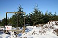
 The trig point on Cairnsmore of Fleet - geograph.org.uk - 963081.jpg 640 × 480; 131 KB
-
 Wanlockhead in the snow - geograph.org.uk - 1227591.jpg 640 × 480; 39 KB
-
 Winter evening at Kirconnel station - geograph.org.uk - 1071837.jpg 480 × 640; 70 KB
-
 Winter skills day at Loch Skeen - geograph.org.uk - 656229.jpg 639 × 438; 129 KB
-
 Wintry conditions on Firthhope Rig - geograph.org.uk - 726003.jpg 640 × 480; 151 KB
-
 Full moon rising over snowfields. - geograph.org.uk - 141635.jpg 600 × 450; 52 KB
-


.jpg)


